Reshaping Local Path Planner
Akshay Sarvesh
Austin Carroll
Swaminathan Gopalswamy
[Paper]

Abstract

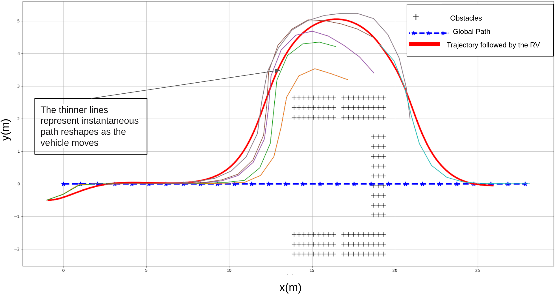
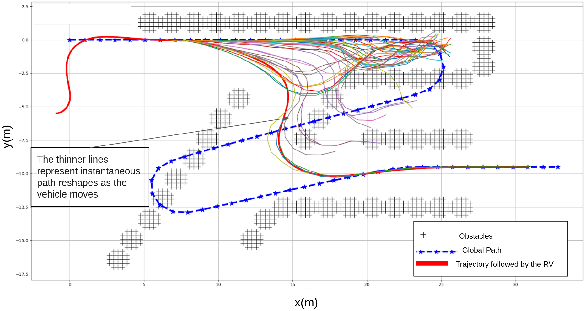
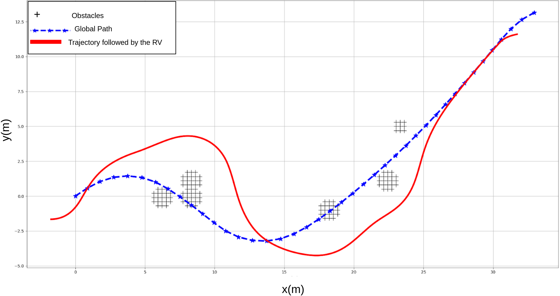
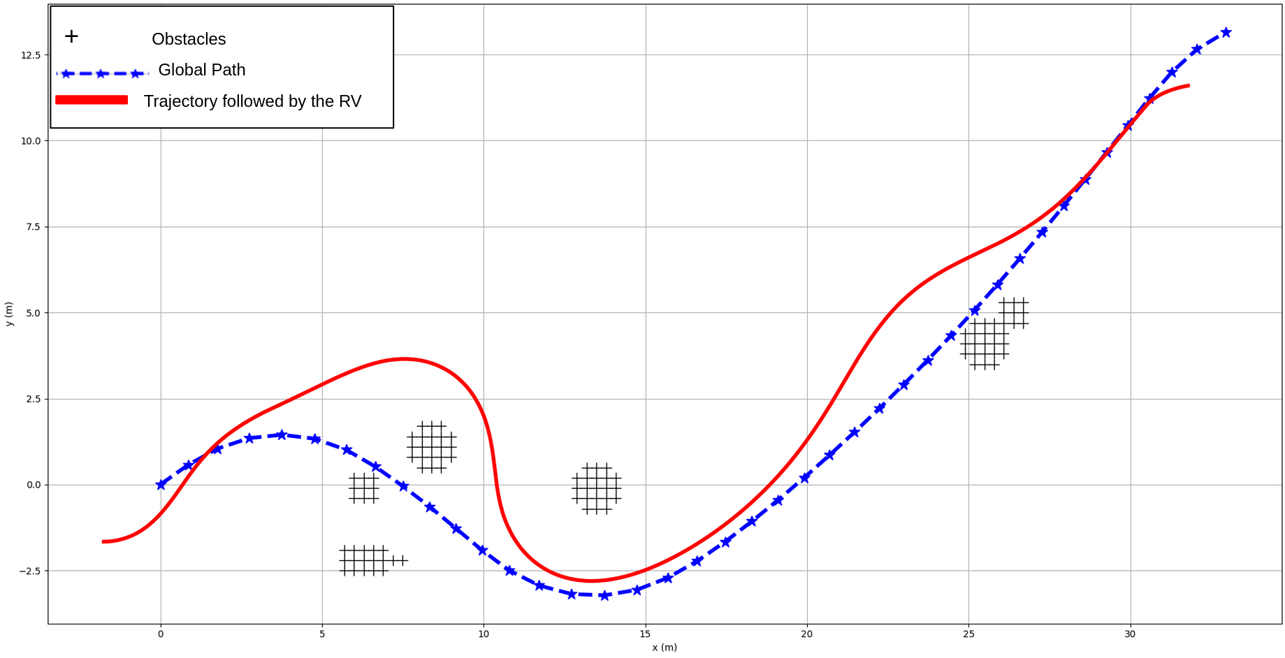
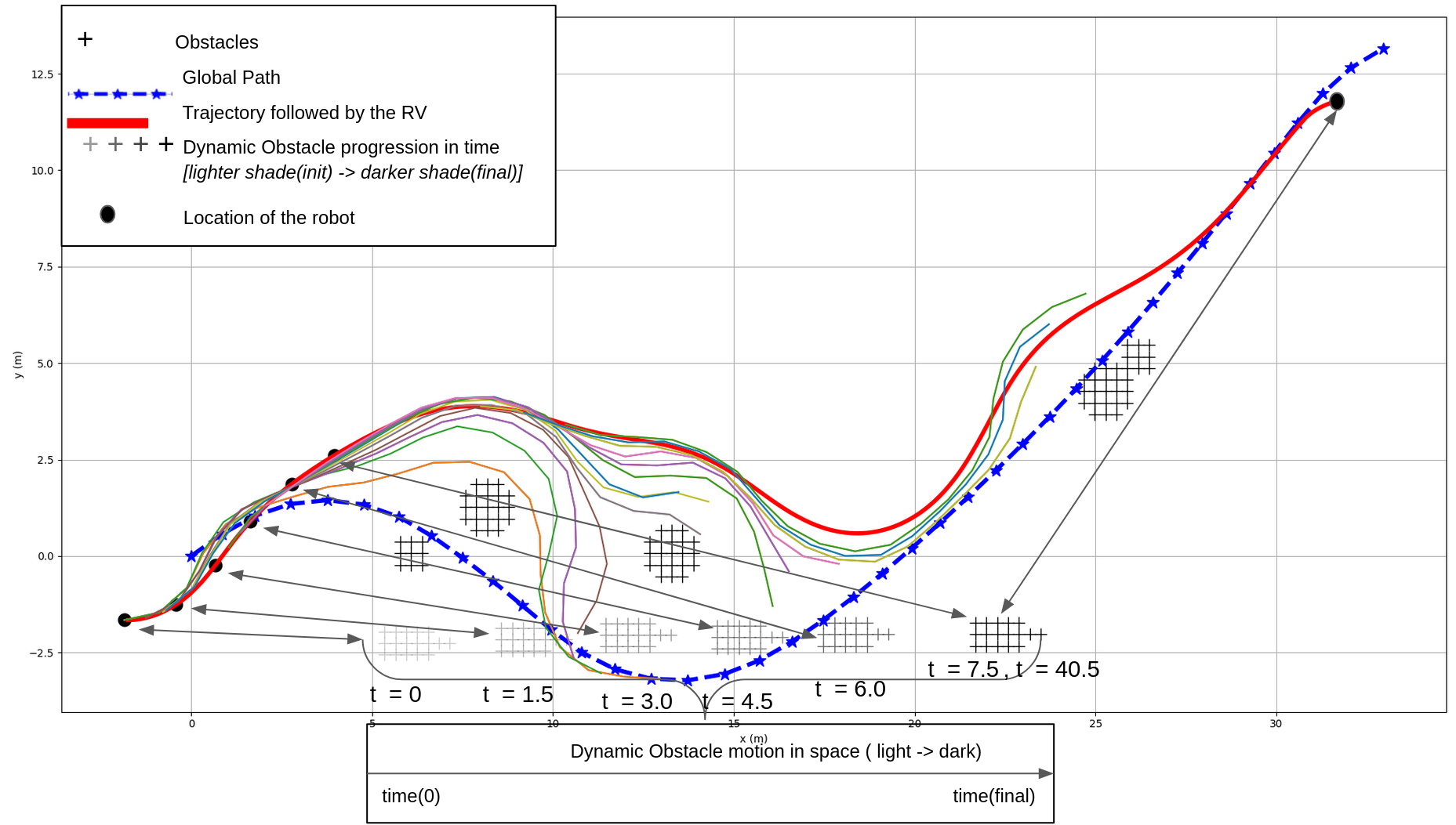
This paper proposes a path planner that reshapes a global path locally in response to sensor-based observations of obstacles in the environment. Two fundamental concepts enable the resultant algorithm (a) a path-following synthetic vehicle whose steering actions are non-myopically 
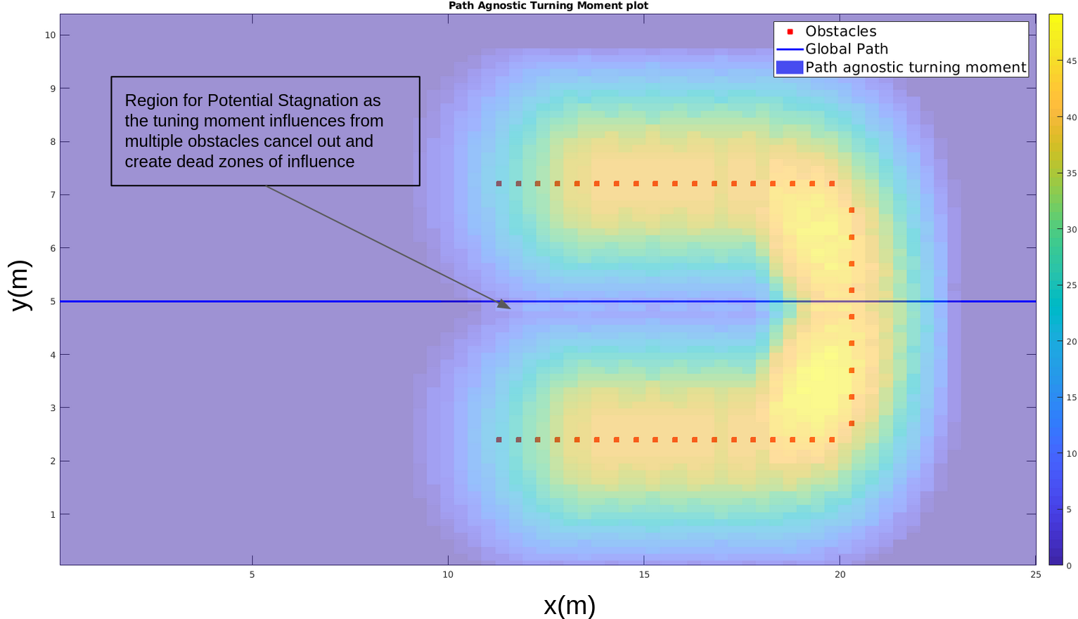
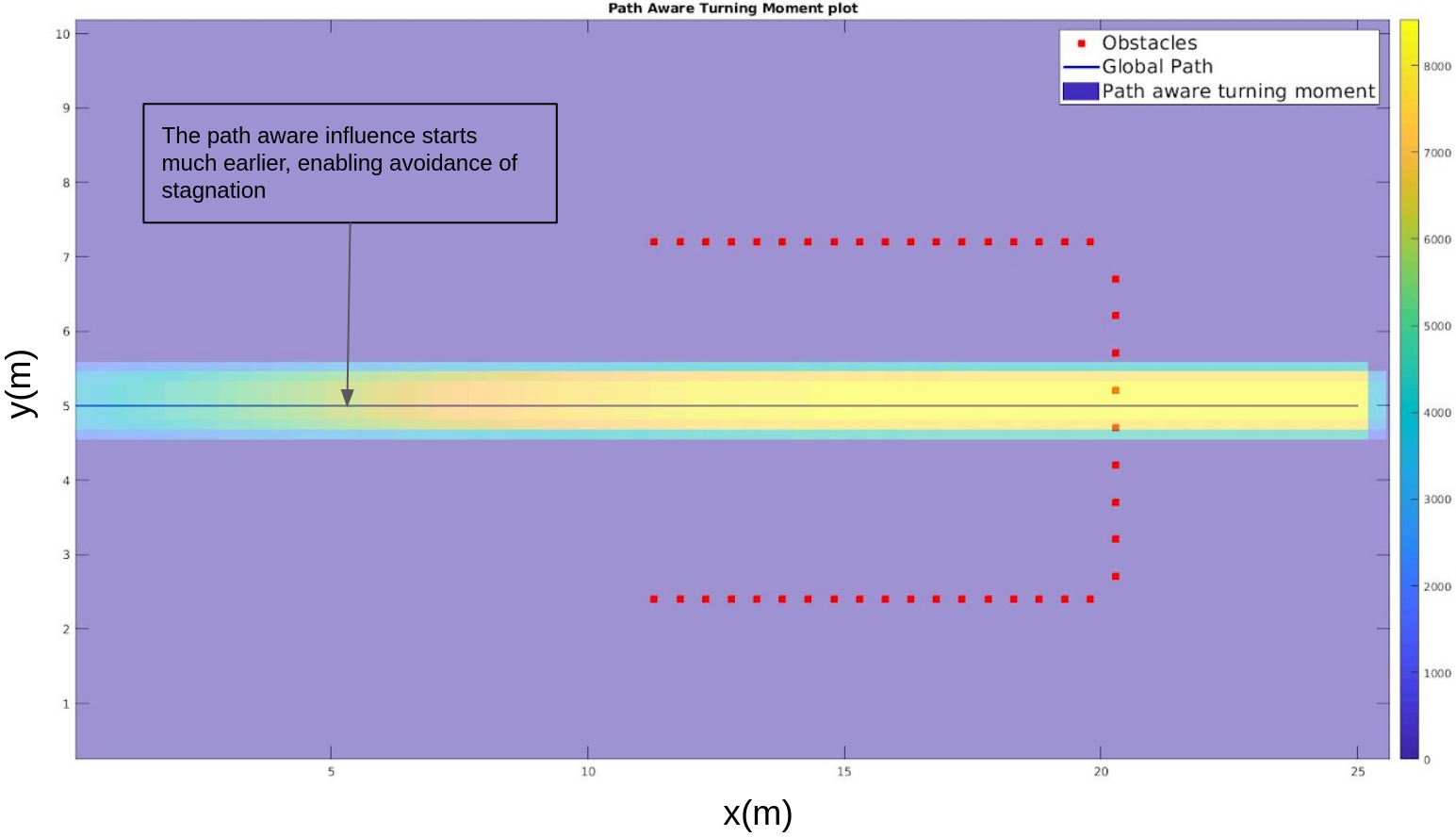
optimized to result in a smooth traversible path that meets path curvature constraints, and (b) a path aware turning moment-field that enables obstacle avoidance while eluding the typical local-minimum-induced stagnation associated with potential field methods. The use of the combination of the two concepts results in a reduced action space over which optimization needs to be performed towards minimizing the path deviation subject to obstacle avoidance, and thus results in an efficient algorithm that can be implemented online. We demonstrate the algorithm 
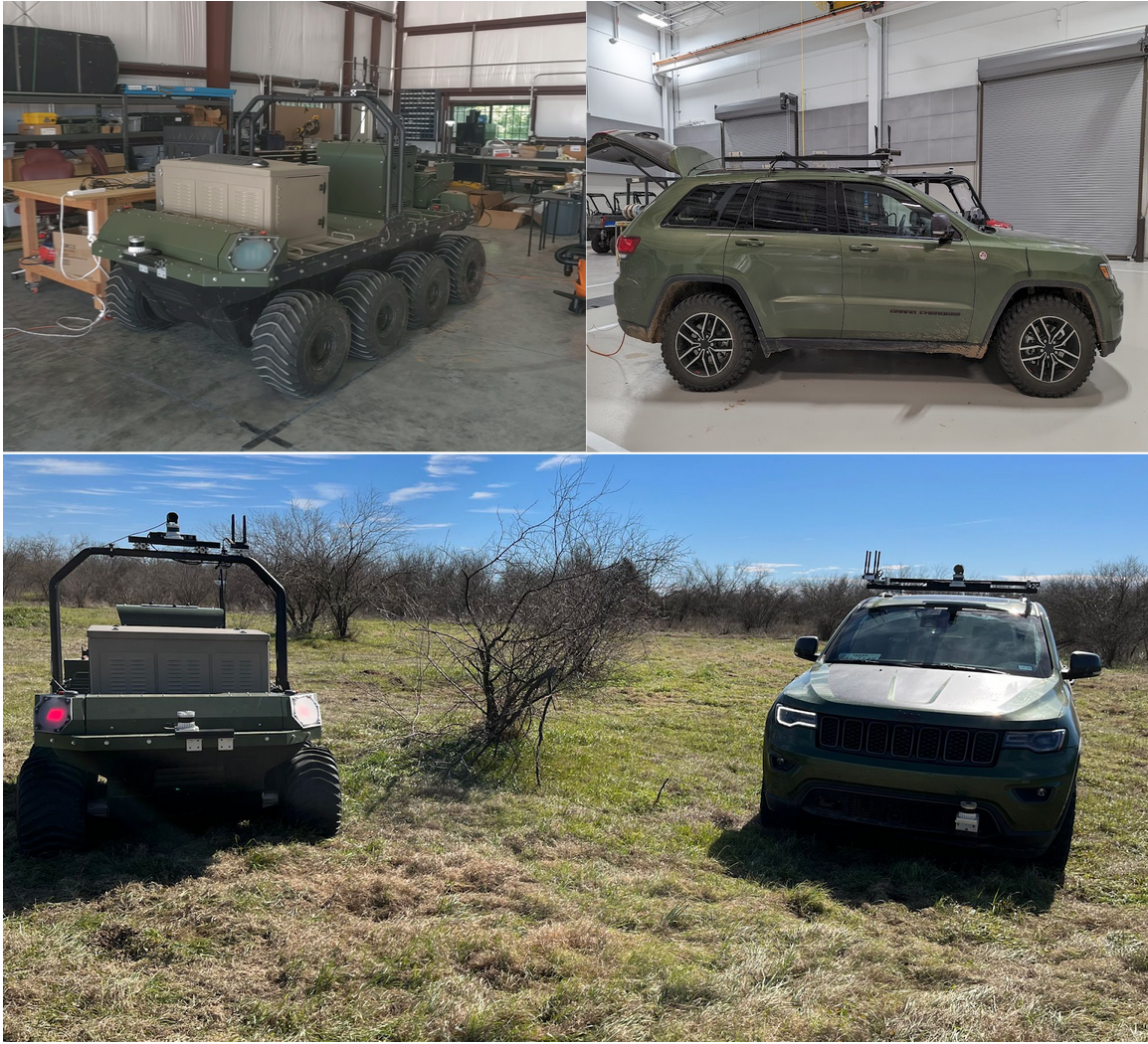
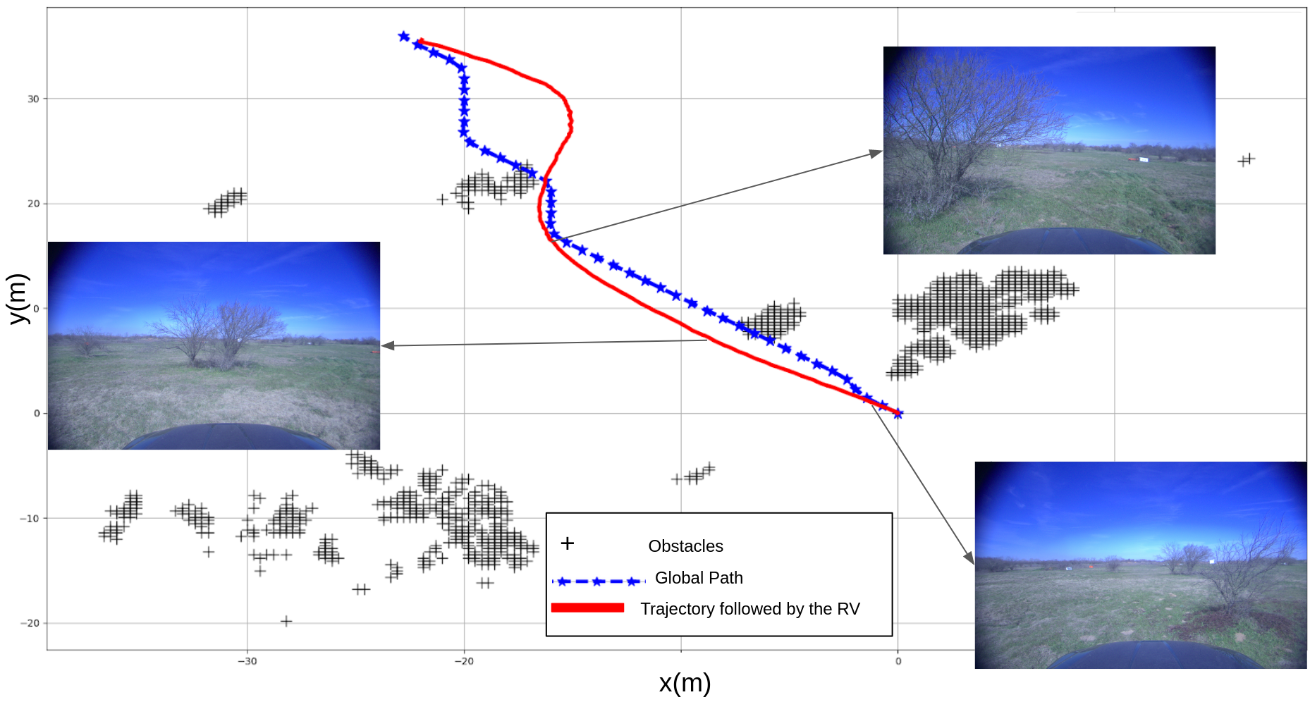
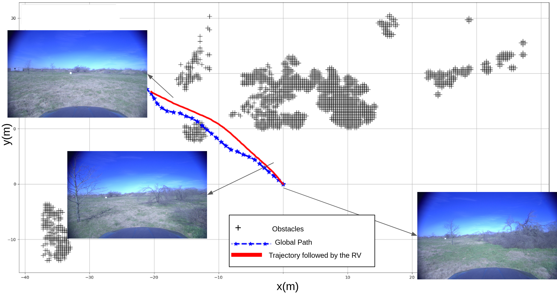
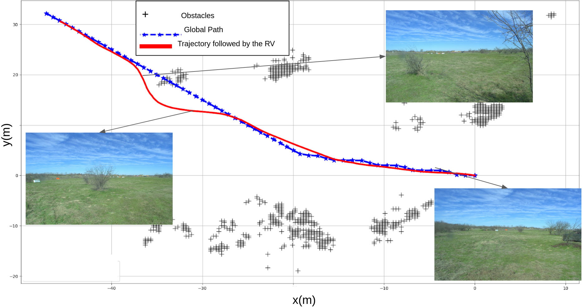
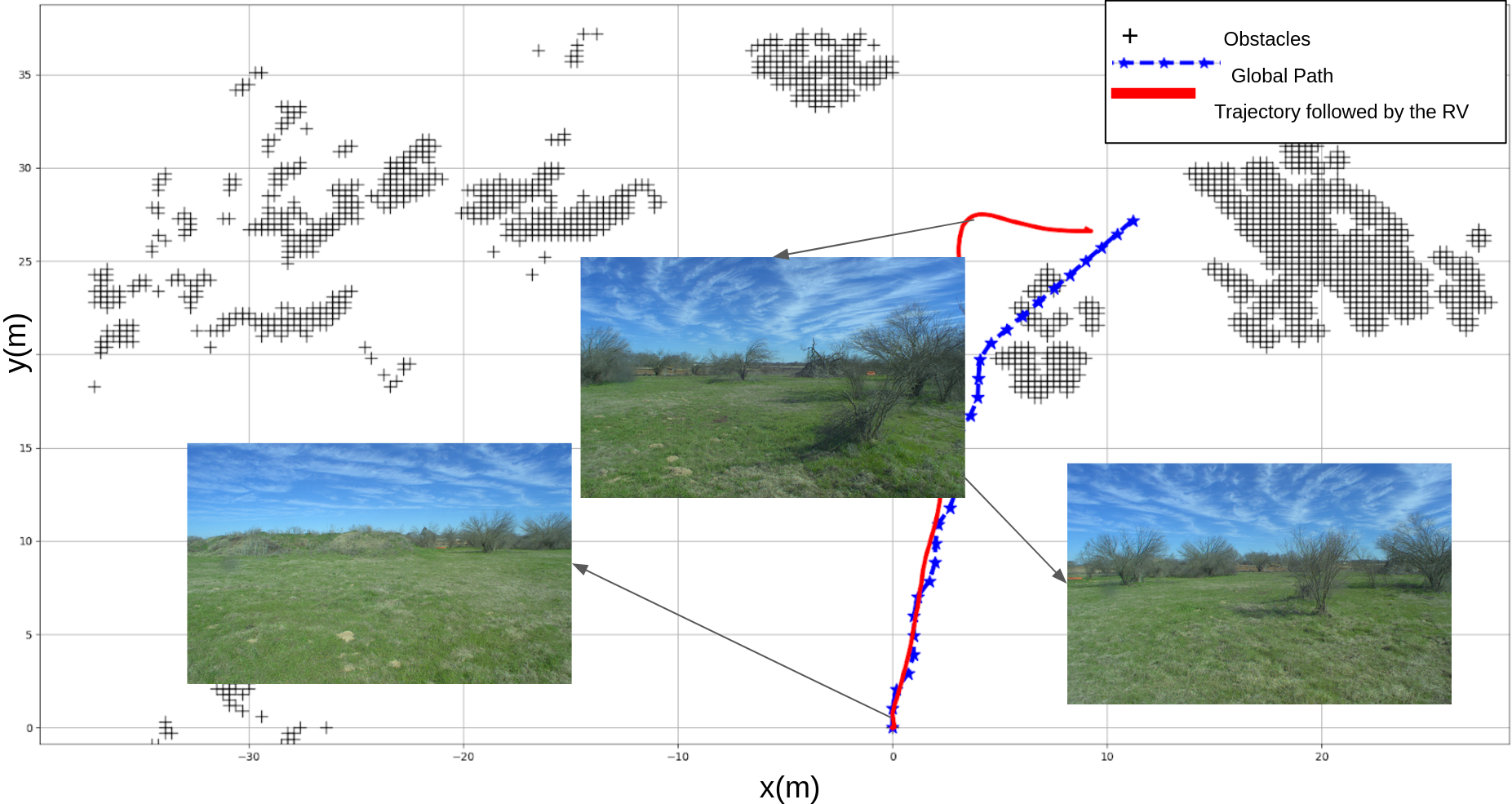
in simulations as well as in field experiments, performing real time local path planning and obstacle avoidance on two different vehicle platforms (an ackerman steering vehicle two-axled vehicle, and a differential-steering 4-axled vehicle) in an unstructured off-road terrain.


Path Moment Plots
Figure 1(a) : Path Agnositc Turning Moment Plot.
Figure 1(b) : Path Aware Turning Moment Plot.
1(a) : The opposing path-agnostic influences of obstacles on either side of the channel result in a region of zero influence leading into the channel cavity. A RV navigating using these moments will be lured into the cavity, but then stagnate as it reaches the obstacles because it can neither go further because of the obstacles, nor can it turn back because of the acceptable turning radius. 1(b) : On the other hand, the path-aware influence can be shaped so it is “sensed” much upstream on the path from the blockage, enabling the vehicle to avoid entering the dead-end.

Video


Scenarios where Potential Field methods fail
Figure 2(a) : Scenario 1 : Avoiding a potential deadend - Sideways U-channel
Figure 2(b) : Scenario 2 : Complex desired path encroaching into obstacles
Two scenarios with potential for getting stuck using standard potential field methods is shown. In both cases the vehicle (dark red line) starts near, but not on, the desired global path (blue line). The obstacles in the sensed environment are represented by an occupancy grid (black +). The lighter colored lines indicate the reshaped local plans at different locations of the vehicle.

Simulation Scenarios in Unstructured Environments
Figure 3(a) : Scenario 1
Figure 3(b) : Scenario 2
Simulation of the Reshaping Local Planner(RLP) on an unstructured environment over a non-straight desired global path.

Simulation Scenarios in Unstructured Environments in presence of Dynamic Obstacle
Figure 4 : Dynamic Obstacle Scenario
Simulation of the Reshaping Local Planner(RLP) on an unstructured environment over a non-straight desired global path.Simulation of the Reshaping Local Planner (RLP) with Dynamic Obstacle (same environment as Fig. 3(b) depicted as moving in space from its initial location (lighter shade of gray) to its final location (darker shade of gray) after which it stops and becomes a static obstacle. The lighter colored lines indicate the reshaped local plans at different locations of the vehicle.

Real Life Robotic Vehicles Simulation in Unstructure Environment at RELLIS campus, Texas A&M University
Figure 5(a) : Robotic Vehicle Platforms used to Validate the Reshaping Local Path Planner through Field Experiments.
Figure 5(b) : Unstructured Environment Scenario 1 for Jeep Cherokee
Figure 5(c) : Unstructured Environment Scenario 2 for Jeep Cherokee
Figure 5(d) : Unstructured Environment Scenario 1 for Clearpath Moose
Figure 5(d) : Unstructured Environment Scenario 2 for Clearpath Moose
The path taken by the RVs (Robotic Vehicles) using the Reshaping Local Path Planner. The reshaped local path is generated continuously as the vehicle moves, and used by the dynamic controls to provide inputs to the DBW system. The global path was generated using stale environment information, and as such the global path goes through obstacles, which the Reshaping Local Path Planner is able to avoid. The sensed environment shown is only a snapshot at the start of the vehicle, the actual environment is continually changing over time as the vehicle moves.

Paper and Supplementary Material

A. Sarvesh, A. Carroll, S. Gopalswamy
Reshaping Local Path Planner.
RAL-IROS, 2022.
(hosted on ieeexplore)


[Bibtex]


Acknowledgements

The authors would like to acknowledge the Research Engineers at BCDC and members of CAST Lab for their input and support. This template was originally made by Phillip Isola and Richard Zhang for a colorful ECCV project; the code can be found here.